🥾🥾🥾🥾
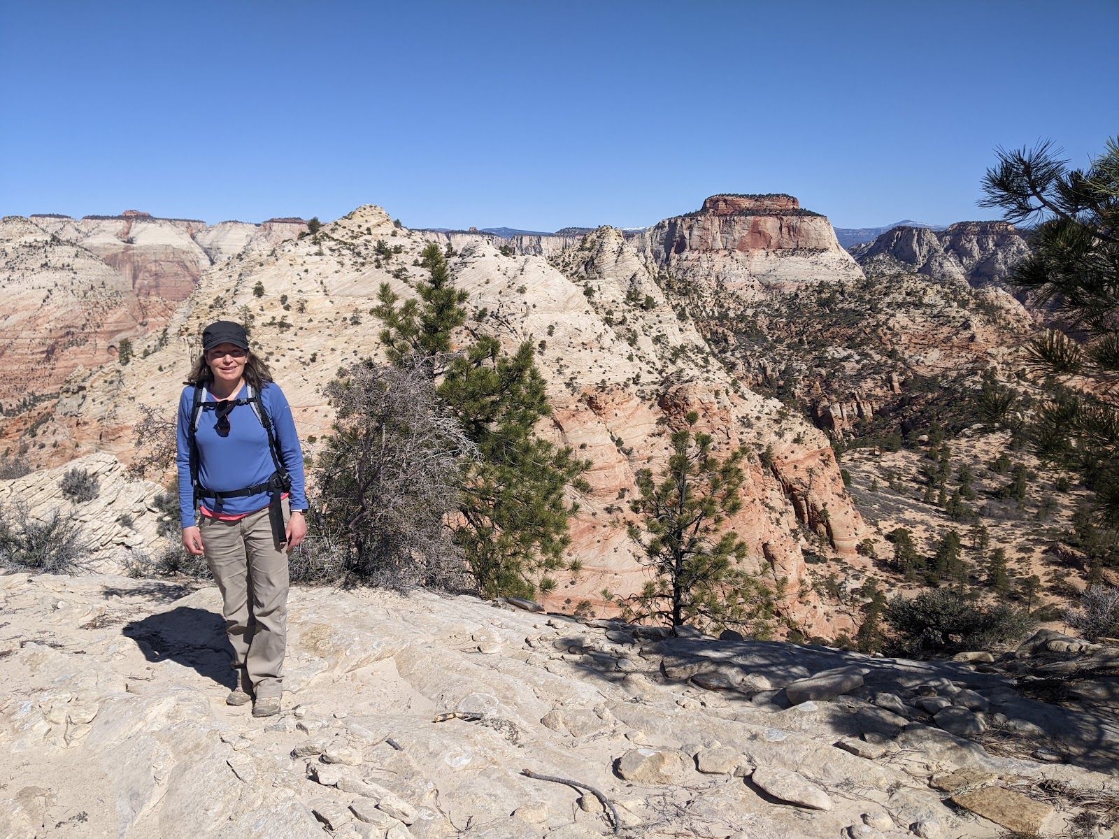
Here's Leti standing in front of the Golden Wall at Buckhorn Point. It was more lovely than we imagined.
Golden Wall/Buckhorn Loop. 4.7 miles. Elevation gain: 1,056 feet. Date hiked: April 6, 2022. Cassidy Trail. 5.6 miles (plus some more). Elevation gain: 682 feet. Date hiked: April 6, 2022
The 2022 Spring Hiking Season has begun! Leti and I decided that for Spring Break we would head to Southern Utah and take in some sights. Today, we went to Red Canyon, which is not far from Bryce Canyon. We are starting the hiking season off right. Our first hike to the Golden Wall was much better than we anticipated. Hence, the four boots instead of three. I usually don't give desert hiking 5 boots because it can be a little drab. However, the views were very beautiful, and the rock formations stunning. We took a little jaunt off the beaten trail to Buckhorn Point. Very, very lovely.
The Golden Wall is behind me, as well as Buckhorn Point.
This trail was also a win because it was a loop. It was fun to traipse back into the mountains knowing we would only pass once.
Our next hike was quite drab in the beginning. As we hiked along, I was reminded of the end of a hike we did a few years back. The hike was spectacular until we got to the last mile. Except this hike's first mile was drab. We hiked for a few miles until we saw anything lovely, to be quite honest. And, there was a lot of horse poop on the trail. 😣 We also met 10 horses coming down the trail. The people on the horses did not look thrilled! I think it was one of those paid horse riding gigs. Perhaps they were bored by the scenery. Hard to say.
I digress, we enjoyed the view when we finally could look into Losee Canyon. We also enjoyed Ledge Point. We could look across the way and see our earlier hike. Very, very pretty.
Me, taking in the view of Losee Canyon. This picture was taken without my consent. Or knowledge.
Overall, it was a lovely day in Red Canyon!
🥾🥾🥾🥾
Hepworth and Roof Peak. Elevation gain: 2112 ft. Length: 6.6 miles. Date hiked: April 7, 2022
Good night, nurse! This hike is not for the faint of heart. I gave it four boots out of five because I got kind of beat up. And, I crab walked so much on this hike. Crab walking occurs when attempting to go down a steep slope on two legs, but four limbs seems much safer so the four limbs wins out.
We had a few false starts. First I forgot my phone in the car. Second, we went the wrong direction to the trail. (We went down the wrong wash.) But, we finally made it, and off we went. There was no trail to follow per se, so we used the downloaded Alltrails map for most of it. The first few miles of this hike were in a wash. It was a beautiful morning, and the rock was very warm looking. So pleasant. And then, we really started to climb. Up, up, up we went, frequently using all four limbs to get up or down.
This was part of the up, up, up. You can see the angle here. A tad steep. But, look at that rock across the way. So beautiful!
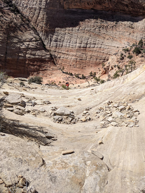
We climbed and climbed more until we got to the base of Hepworth peak. At the base there is a bowl. It looks like:
This is Leti in the bowl. Epic looking if you ask me.
From the base of the bowl, again using all four limbs, we climbed to the top of Hepworth Peak. Here's what the climb looked like:
The bowl from the above picture is below me. Hard to tell, but this is steep.
Another picture of the ascent. The bowl is below me. And, I am making my way to the top. I'm in pink in the center of the picture.
This was a bit of a beast to go up, but it went quickly. And, the view from the top was just beautiful!
Here's Leti at the top. Roof Peak is across the way. The bowl we've been speaking of is below roof peak. Also, you could see for miles at the top!
A view from the top of Hepworth. Beautiful!
While at the top of Hepworth, Leit spotted this friend:
Hello Desert Bighorn Sheep friend! This guy was not fond of our presence. He looked upon us with a suspicious eye. I don't think he gets a lot of visitors. And, I think he likes it that way.
So, the very strange thing about this hike is: we saw exactly zero people. But, we did see 6 Bighorn Sheep! So, we had some company. We left Hepworth and went across the way to Roof Peak. It was beautiful and a little terrifying.
Here's Leti on the edge of Roof Peak. She was not allowed to stand up for the picture - photographer's orders! It was beautiful up there!
Another beautiful picture from the top of Roof Peak.
We left the Roof Peak and headed back to the car. We made it back to the famous bowl which has been mentioned several times in this post. In the bowl, I was stabbed violently by a yucca plant! It got me in four different spots. I walked to close to it, and paid for the mistake in blood and bruises. We had to stop and bandage the worst wound, but after that, I steered clear of those plants! I have gnarly bruises still. #notafanofyucca
The rest of the hike was interesting because we couldn't always remember how we came. The lighting was different, so it changed everything. Also, there isn't really a trail to follow. We stopped and prayed once because we couldn't figure out how to get down. Our prayers were answered as we took a few different routes down. As we descended, we ran across these charming beasts:
Five charming Desert Bighorn Sheep, we think. That was fun. :) They didn't like us either, and they seemed to track us for a time. #FBIsheep
The end of this trail was brutal. I think if we could have shaved off the last mile, we would have, but no can do. We were grateful to get out of the wash onto our next adventure! However, we thought this hike was really spectacular. The view and the experience were worthwhile. And, I was stabbed by a yucca plant. Exciting!
🥾🥾🥾🥾
Observation Point via East Mesa Trail. Elevation gain: 702 feet. Length: 7 miles. Date hiked: April 7, 2022
This hike actually had a trail to follow. And, we saw a lot of people. But, I thought the views were worth it. We didn't hike from the canyon floor because there was a rock slide that wiped out part of the trail. So, not a lot of elevation gain here. I gave this hike four out of five because of the number of people, and part of the trail was drab! But, the views at the end were beautiful!
From the above picture, you can see the road on the valley floor. Also, just to the right of the picture, you can see the rock that makes up Angel's Landing. #safetythird This view of Angel's Landing did not inspire me to want to hike it again. I was happy to be on the other side.
I like this picture. You can clearly see the road as well as Angel's Landing, and Leti. :)
Here's another view of the top , just a little farther over. The rock faces along here are just spectacular!
It was another lovely hike in the books!
❄❄❄❄❄
Cedar Break National Monument. Elevation gain: ? Length: 6 miles. Date hiked: April 8, 2022.
I gave this hike five snowflakes out of five snowflakes because we literally had Cedar Breaks to ourselves! Granted, we put on our microspikes and headed up the road for 3 miles, but it seemed like a small price to pay for having this beautiful spot to ourselves!
This is what our trail to Cedar Breaks looked like when we hiked - a white out with some trees. Luckily, we had our sunglasses and sunscreen. It was lovely!
The snowy side of Cedar Breaks.
When we got to the monument, there was pavement with no snow on it. Also, we had our pick of multiple benches. Leti flattened out on the pavement for a nap, and I took a bench. It was just perfect! It was so quiet that we could hear rock falls at the monument. Because the snow was melting, it seemed like there were several rock falls. After some significant time eating, napping, and viewing, we headed back to the car. Downhill in spikes was much easier than uphill in spikes. It was a great, great adventure!
We headed next to Aunt Sue's diner for lunch, which was just perfect. If you are at Duck Village, Aunt Sue's does not disappoint. Next, after changing out of our wet clothes, we went back to Red Canyon. I read on a sign that Casto Canyon is like Bryce, minus the crowds. #facts. This hike never did gain elevation, but went along a gigantic wash. We walked along for about 3 ish miles. It was beautiful
🗻🗻🗻🗻
Casto Canyon. Elevation gain: not much. Length: we went about 6 miles. Date hiked: April 8, 2022.
Casto was lovely! It was the perfect way to end our hiking adventure for the day. As we drove up, two people were coming out of the canyon on dirt bikes. And that is the last we saw of people and civilization. We walked along this beautiful canyon for miles, and never saw another soul. I gave it four out of five mountains because the views were beautiful, but the rocks on the trail were less fun.
This is basically what Casto looked like the entire time. Beautiful red rock on both sides. Lovely.
🥾🥾🥾🥾🥾
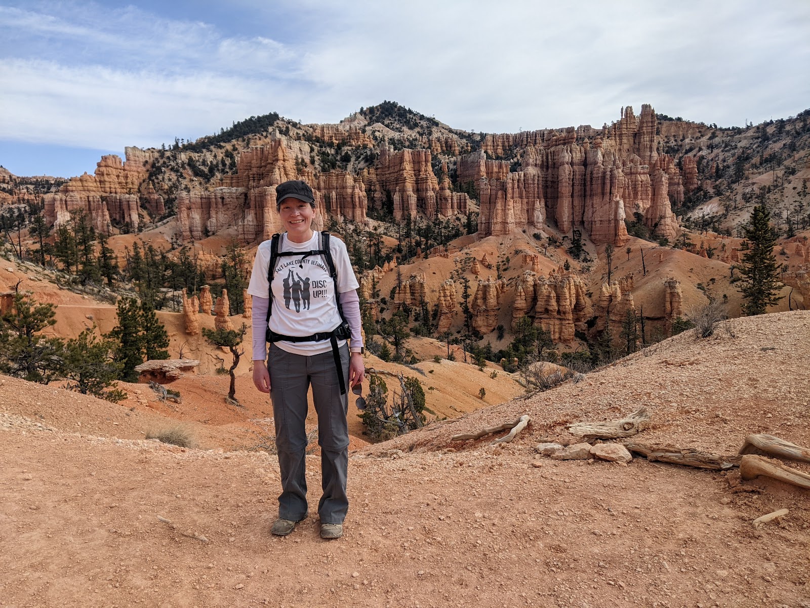
Fairyland Loop. Elevation gain:1545 feet. Length: 7.8 miles. Date hiked: April 9, 2022.
I gave this trail 5 out of 5 boots. It was just beautiful, there was an actual trail to follow, and it wasn't rocky. #win This was the last hike of our vacation. And, it was stunning. There were so many spots that we stopped to take pictures. And, yet, we couldn't capture the beauty. It was that kind of hike. I also liked that it was a loop.
Here I am on the trail. I look like a very small tree. I love this picture because it gives you scale. :)
Why do I have my hand on my hip? No idea. Isn't the scenery so pretty?!
More beautiful scenery!
This hike, being a loop, we went clockwise. That was the right way to go. You see stunning views for the first several miles! The last mile is a bit dry, but after having seen so much beauty, it was fine to have a dry spot of trail. I love that the trail descended and descended, deeper and deeper into Fairyland! I enjoyed the washes and the high rock walls. It really was stunning! Another beautiful day of hiking!


Comments
Post a Comment